This is Doggerland on the right, look how over the millennia the sea has eroded our coastline and turned the Marshie salt flats into the mud at the bottom of the English Channel… whilst on the left is the weather forecast regions, divided up for you, so go and check the shipping forecast and get the best weather prediction for beach detecting…


Map of England from Cassell’s History of England is a map showing the Anglo-Saxon Kingdoms & Danish Districts…
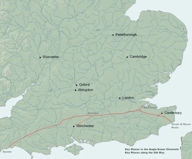
Below is the Harrow Way (also spelled as “Harroway”) which is another name for the “Old Way”, an ancient trackway in the south of England, dated by archaeological finds to 600–450 BC, but probably in existence since the Neolithic Period, many fields along the way and ancient trackways are worth looking at, for hoards, market sites, and gathering places… also why not look at where the Romans were and check them out for the same principal Roman Occupation around England…
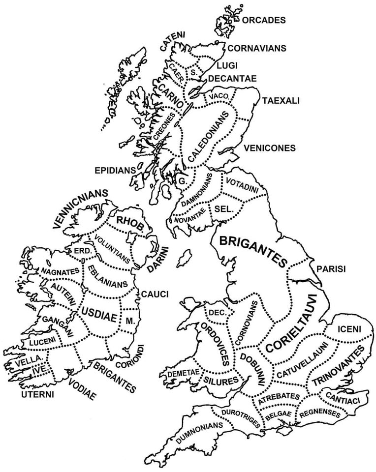
Tribes of England…
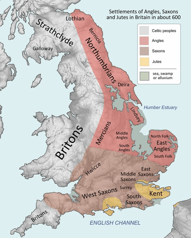
Looking at the settlers from the Romans onward…